Reading...
![]()
Play button
![]()
Play button
![]()
Use LEFT and RIGHT arrow keys to navigate between flashcards;
Use UP and DOWN arrow keys to flip the card;
H to show hint;
A reads text to speech;
24 Cards in this Set
- Front
- Back
|
The pitot-static system provides the source of air pressure for the operation of the following instruments
|
-altimeter
-vertical speed indicator -airspeed |
|
|
two major parts if the pitot-static system
|
-the pitot tube with impact pressure chamber and lines
-the static air vents with static pressure chamber and lines |
|
|
What does the pilot has to check before departuring?
|
check for any blockage
|
|
|
what are static air vents?
|
the source of external atmospheric pressure
|
|
|
The pitot tube is the source of what?
|
Impact pressure
|
|
|
What does blockage of static vent creates?
|
Erroneous reading by all three pitot system instruments
|
|
|
Sectional aeronautical charts
|
used by slow and medium speed aircraft flying on Visual Flight Rules (VFR)
|
|
|
How often is the Sectional aeronautical charts often?
|
Every 6 months
|
|
|
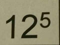
Maximum Elevation Figure bounded by lines of latitude and longitude. Large number represent Thousand of feet and small number represents hundreds of feet above mean sea level (MSL)
|
|
|
Airports with control towers are always depicted
|
In the color blue
|
|
|
In the airport data "450 L 51 122.7" the letter "L" indicates
|
The airport has runway lighting
|
|
|
In the airport data "4500 L 72 122.95" , "4500" is the
|
Airport elevation above sea level
|
|
|
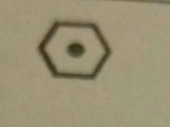
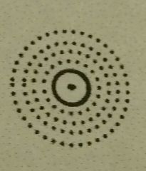
VHF omni Range (VOR)
|
|
|
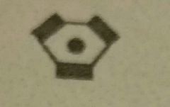
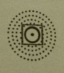
Vortac
|
|
|
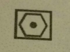
VOR DME (Distance Measuring Equipment)
|
|
|
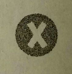
Non-Directional Radiobeacon (NDB)
|
|
|
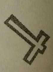
NDB-DME
|
|
|
(Sectional Aeronautical Charts) The height of an obstruction is indicated on the chart in fret above
|
Both ground level and sea level
|
|
|
Sectional Aeronautical Chart are publish how often?
|
Every 6 months
|
|
|
Map Scale for Sectional Aeronautical Charts
|
1 inch= 6.86 NM
|
|
|
Basic terrain contour lines are spaced at __________ intervals
|
500 foot
|
|
Color Magenta
|
Hard surfaced runways 1500 ft to 8069 ft in length. (For all others except control towers)
|
|

Color Blue
|
Hard Surfaced runways 1500 ft to 8069 ft in length (For control towers)
|
|
Color Blue
|
(Control Towers) Hard-surfaced runways greater than 8069 ft or some multiple runways less than 8069 ft
|