![]()
![]()
![]()
Use LEFT and RIGHT arrow keys to navigate between flashcards;
Use UP and DOWN arrow keys to flip the card;
H to show hint;
A reads text to speech;
44 Cards in this Set
- Front
- Back
|
What are some ways that relative location can be described? (HINT: What does relative mean?) |
a connection between two places, such as "next to", "near", or "bordering". |
|
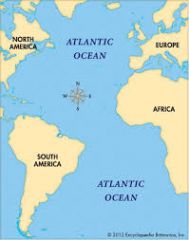
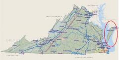
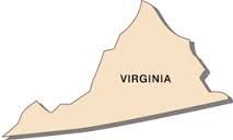
What large bodies of water border Virginia? |
|
|
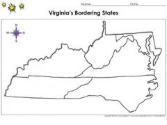
What states border Virginia? |
|
|
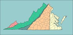
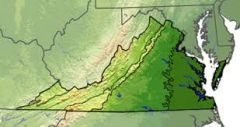
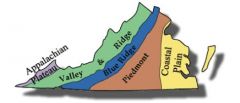
What are Virginia's 5 geographic regions? |
1. Coastal Plain (Tidewater) 2. Piedmont 3. Blue Ridge 4. Valley & Ridge 5. Appalachian Plateau |
|
|
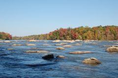
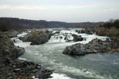
What is the Fall Line? |
the natural border between the Coastal Plain (Tidewater) and Piedmont regions, where waterfalls prevent further travel on the river |
|

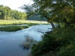
Describe Virginia's Coastal Plain (Tidewater) region |
|
|

Describe Virginia's Piedmont region |
|
|

Describe Virginia's Blue Ridge Mountains region |
|
|
Describe Virginia's Valley & Ridge region |
|
|

Describe Virginia's Appalachian Plateau region |
|
|
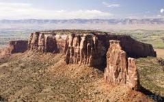
What is a 'plateau'? |
area of elevated land that is flat on top |
|
|
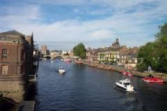
Why are water features important to the early history of Virginia? |
(Many early Virginia cities developed along the Fall Line)
|
|
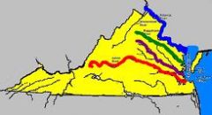
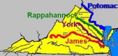
What are the 4 rivers in Virginia? |
|
|
|
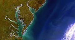
Where do the 4 major rivers flow into that are separated by peninsulas? |
Chesapeake Bay |
|
Chesapeake Bay |
|
|
Atlantic Ocean |
|
|
James River |
|
|
York River |
|
|
Potomac River |
|
|
Rappahannock River |
|
|
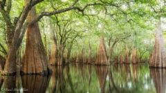
Lake Drummond |
|
|
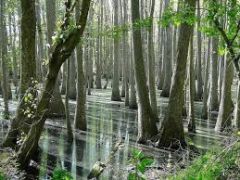
Dismal Swamp |
|
|

What is a peninsula? |
a piece of land bordered by water on three (3) sides |
|
Eastern Shore |
a peninsula bordered by the Chesapeake Bay to the west and the Atlantic Ocean to the east |
|
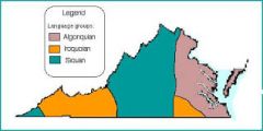
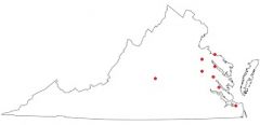
Locate the three (3) American Indian language groups on the map of Virginia |

|
|
|
Who were the first people to live in Virginia? |
American Indians |
|
|
Why are the native peoples called Indians? |
Christopher Columbus called the people he found in the lands he explored "Indians" because he thought he was in the Indies (near China) |
|
|
What evidence is there that American Indians lived in all areas of the state? |
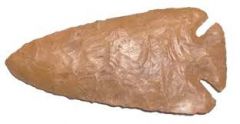
Artifacts such as arrowheads, pottery, and other tools that have been found tell a lot about the people who have lived here in Virginia. |
|
|
What were the three (3) major language groups found in Virginia? |
|
|
Algonquian language |

|
|
Siouan language |

|
|
Iroquoian language |
|
|
|
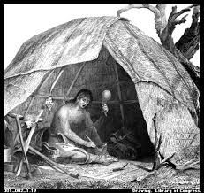
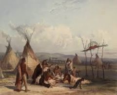
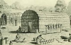
How did American Indians relate to the climate and their environment to secure food, clothing, and shelter? |
Virginia's American Indians worked with the climate and their environment to meet their basic needs
|
|
|
What are some characteristics of Virginia's climate? |
The climate in Virginia is relatively mild with distinct seasons (spring, summer, fall, and winter), resulting in a variety of vegetation
|
|
|
What are some ways Virginia's American Indians related to the climate and interacted with their environment to meet their basic needs? |
The kind of food they ate, the clothing they wore, and the shelters they had depended upon the seasons
|
|
|
Indian American foods according to the seasons (winter, spring, summer, fall) |
|
|
|
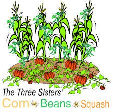
What were the three sisters? |
|
|
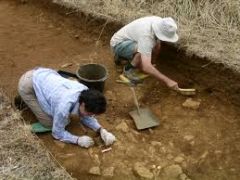
What is archaeology? Who are archaeologists? |
Archaeology is another way that helps people understand the pant
|
|
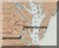
What was Werowocomoco? |
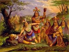
|
|

What was Jamestown? |
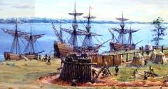
|
|
|
How can new findings change the understanding of history? |
the recovered artifacts give archaeologists clues about the interactions of English, Africans, and Indians in early Virginia |
|

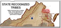
Identify and locate the current state-recognized tribes |
|
|
Tribes located in the Coastal Plain (Tidewater) region |
|
|

Tribe located in the Piedmont region |
|