Reading...
![]()
Play button
![]()
Play button
![]()
Use LEFT and RIGHT arrow keys to navigate between flashcards;
Use UP and DOWN arrow keys to flip the card;
H to show hint;
A reads text to speech;
30 Cards in this Set
- Front
- Back
|
hemisphere
|
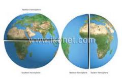
Half of the globe.
|
|
|
longitude
|
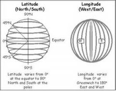
Distance east or west of the prime meridian, measured in degrees.
|
|
|
latitude
|
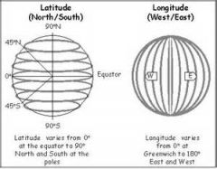
Distance north or south of the equator, measured in degrees.
|
|
|
meridian
|
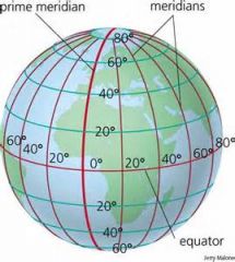
An imaginary line that passes through all points of the same longitude.
|
|
|
parallel
|
An imaginary line on the earth connecting points of equal latitude.
|
|
|
cartography
|
The making and study of maps and charts.
|
|
|
equator
|
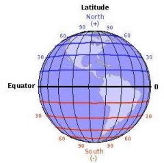
An imaginary circle around the middle of the earth, halfway between the North Pole and the South Pole.
|
|
|
Tropic of Cancer
|
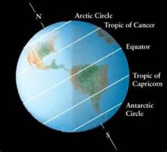
The paralled of latitude that is 23 degrees 30 feet north of the equator.
|
|
|
Tropic of Capricorn
|

The parallel of latitude that is 23 degrees 30 feet south of the equator.
|
|
|
Arctic Circle
|
The imaginary boundary of the north polar region, at 66 degrees 30 feet north latitude.
|
|
|
Antarctic Circle
|
The imaginary boundary of the south polar region, at 66 degrees 30 feet south latitude.
|
|
|
poles
|
Either end of the earth's axis, located at 90 degrees north latitude or 90 degrees south latitude.
|
|
|
axis
|
An imaginary rod on which the earth rotates.
|
|
|
prime meridian
|

The meridian of 0 degrees longitude that passes through Greenwich, England and from which other longitudes are measured east and west.
|
|
|
international date line
|
An imaginary line where each calendar day first begins, running mostly along 180 degrees longitude.
|
|
|
time zones
|
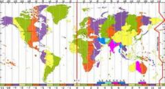
A series of 24 zones, each 15 degrees, determined approximately by meridians, within which the same standard time is used.
|
|
|
west
|
The direction from the international date line that the next day begins.
|
|
|
daylight savings
|
A system instituted by the U.S. to take advantage of the extra hours of daylight in the summer.
|
|
|
globe
|
A true representation of the shape of the earth.
|
|
|
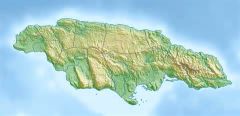
physical map
|
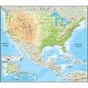
A map that shows the natural features of the earth's surface.
|
|
|
political map
|
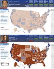
A map that shows boundaries of nations and other cultural features.
|
|
|
topographic map
|
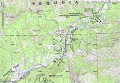
A map that shows elevations as well as the positions of points, often in color and with contour lines.
|
|
|
relief map
|
A map that employs different color, in a definite order, to distinguish land at differing heights and water at varying depths.
|
|
|
mercator projection map
|
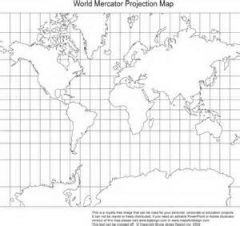
A cylindrical map projection in which the distortion of areas increases asit nears the poles, but is essential for marine navigation.
|
|
|
legend
|
A key telling what symbols are used on a map to represent various features.
|
|
|
symbol
|
A letter, picture, or sign that represents something on a map.
|
|
|
scale
|
The ratio (relationship) between a given distance on the earth's surface and the same distance as represented on a map.
|
|
|
grid
|
A system comprised of parallels and meridians for locating places on the earth's surface.
|
|
|
contour lines
|
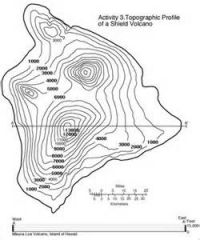
Lines drawn on a map connecting all points that are the same altitude above the sea.
|
|
|
isotherms
|
Lines on a map that join all places having the same temperature. (iso) equal (therm) heat or temperature, type of contour line
|