![]()
![]()
![]()
Use LEFT and RIGHT arrow keys to navigate between flashcards;
Use UP and DOWN arrow keys to flip the card;
H to show hint;
A reads text to speech;
10 Cards in this Set
- Front
- Back
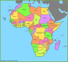
This map is an example of a _________ map that shows country or state boundaries. |
Political |
|
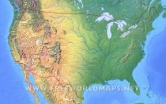
This map is an example of a __________ map that shows major landforms of a place. |
Physical |
|
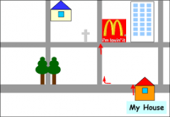
This map is an example of which of the 5 Themes of Geography? |
Relative Location |
|
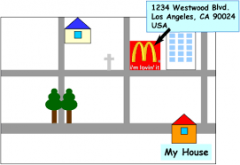
This map is an example of which of the 5 Themes of Geography? |
Absolute Location |
|
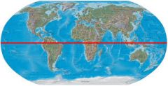
The horizontal line (-) represents a imaginary line called the __________. |
Equator |
|
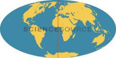
The vertical line (l) represents an imaginary line called the _____. |
Prime Meridian |
|
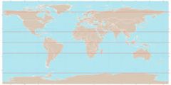
The horizontal lines (-) represent imaginary lines of ___________. |
Latitude |
|
The vertical lines (l) represent imaginary lines of ___________. |
Longitude |
|
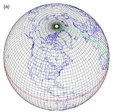
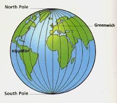
This map represents a ___________. |
Global Grid |
|
|
a long high sea wave caused by an earthquake, submarine landslide, or other disturbance. |
Tsunami |