![]()
![]()
![]()
Use LEFT and RIGHT arrow keys to navigate between flashcards;
Use UP and DOWN arrow keys to flip the card;
H to show hint;
A reads text to speech;
29 Cards in this Set
- Front
- Back
|
Coastal Range |
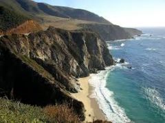
Rugged mountains along the Pacific Coast that stretch from California to Canada.Contains fertile valleys. |
|
|
Basin and Range |
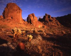
located west of the Rocky Mountains and East of the Sierra Navada and the Cascades.Varying elevations with isolated mountain ranges-contains death valley. |
|
|
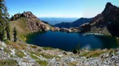
Rocky Mountains |
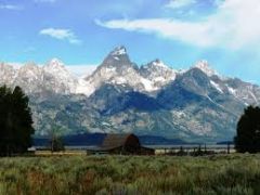
Located west of the Great Plains and east of the Basin and Range. Rugged mountain-stretch from alaska to almost mexico.Contains the continental divide . Determines the directional flow of rivers. |
|
|
Great Plains |
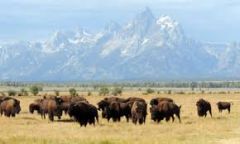
Located west of the Interior Lowlands and east of the Rocky Mountains.Flat lands that gradually increase in elevation westward:grasslands |
|
|
Interior lowlands |
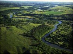
Located west of the Appalachian Mountains and east of the Great Plains.Rolling flatland's with many rivers,broad river valleys and grassy hills. |
|
|
Appalachian Highlands |
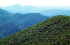
Located west of the Coastal Plain extending from eastern Canada to western Alabama.Old eroded Mountains. oldest mountain range in North America.
|
|
|
Coastal Plains |
Located along the Alantic Ocean and Gulf of Mexico.Broad lowlands that provide many excellent harbors. |
|
|
Canadian Shield |
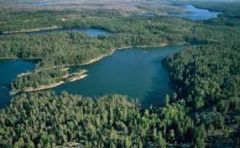
Wrapped around the Hudson Bay in a hourse shoe shape.Hills worn by erosion. hundreds of lakes carved by glaciers |
|
|
Alantic Ocean |
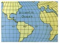
Served as an early highway for explorers ,early settlers ,and immigrants. |
|
|
Pacific Ocean |
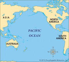
Early exploration destination. |
|
|
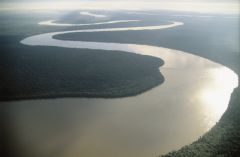
Mississippi River |

Used to transportfarm and industrial products-most famous river. |
|
|
Missouri River |
Used to transport farm and industruial products-longest river |
|
|
Ohio River |

Gateway to the west. |
|
|
Columbia River |

Explored by Lewis and Clark |
|
|
Colorado River |

Explored by the Spanish |
|
|
Rio Grande River |

Forms the boarder between Mexico and the U.S.A. |
|
|
St.Lawrence River |

North-east boarder with Canada-connects the great lakes to the Atlantic Ocean. |
|
|
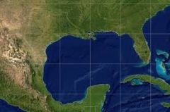
Gulf Of Mexico |

Provdied the french and spanish with an exploration route to Mexico And America. |
|
|
Great Lakes |
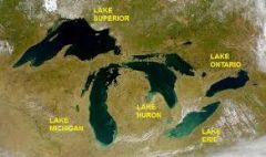
Inland port city's grew here in the mid west H-Huron O-Ontario M-Michigan E-Erie S-Superier
|
|
|
Lake |
A large inland body of water |
|
|
River |
A large natural stream of water. |
|
|
Tributary |
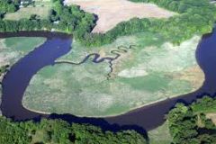
A smaller stream that flows into a river/ocean/lake. |
|
|
Gulf |
A large area of se or ocean parrtially enclosed by land. |
|
|
Bay |
A body of water partilly inclosed by land.typically smaller that a gulf. |
|
|
Mountain |
A natural elevation of the earth's surface having considerable mass;hieght greater than a hill. |
|
|
Hill |
A well-defined natural elevation smaller than a mountain. |
|
|
Plain |
A large relatively flat area of land |
|
|
Plateau |
A large,relativly flat,but elevated area of land |
|
|
Island |
A land mass-smaller that a continent by water |