![]()
![]()
![]()
Use LEFT and RIGHT arrow keys to navigate between flashcards;
Use UP and DOWN arrow keys to flip the card;
H to show hint;
A reads text to speech;
19 Cards in this Set
- Front
- Back
|
Coastal Range |
Rugged mountains along the Pacific Coast that stretch from California to Canada fertile valleys |
|
|
Basin & Range |
Located west of Rocky Mountains and east of the Sierra Nevada and the Cascades varying elavations with isolated mountain ranges death valley lowest point in North America |
|
|
Rocky Mountains |
Located west of the Great Plains and east of the Basin & Range rugged mountains that stretch from Alaska to almost Mexico continental divede |
|
|
Great Plains |
Located west of the Interior Lowlands and east of the Rocky Mountains flat lands that gradually increase in elavation west ward grasslands |
|
|
Interior Lowlands |
Located west of the Appalachian Mountains and east of the Great Plains rolling flatland with many rivers; broad river valleys and grassy hills |
|
|
Applachian Highlands |
Located west of the Costal Plain extending from eastern Canada to western Alabama; includes piedmont old eroded mountains oldest mountain range in North America |
|
|
Coastal Plains |
Located along the Atlantic Ocean and Gulf of Mexico broad lowlands that provide many excellent harbors |
|
|
Canadian Shield |
wrapped around the Hudson Bay in a horseshoe shape hills worn by erosion hundreds of lakes carved by glaciers |
|
|
Atlantic Ocean |
Highway for earl explorers,early settlers,and later immigrants |
|
|
Pacific Ocean |
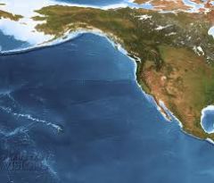
Early exploration destanation |
|
|
Mississippi River |
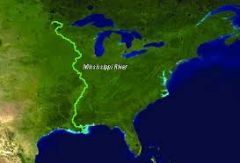
Transport farm and industriual products-most famos river |
|
|
Missouri River |
(same as above) longest river |
|
|
Ohio River |
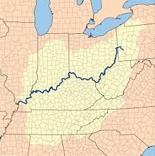
gateway to the west |
|
|
Columbia River |
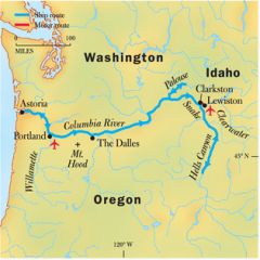
was explored by Lewis and Clark |
|
|
Colorado River |
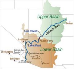
was explored by the spanish (Coronado) |
|
|
St.Lawrence River |
northeastern border with Canada-connects great lakes to the Atlantic Ocean
|
|
|
Rio Grande |
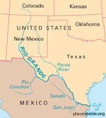
border between mexico and usa |
|
|
Gulf of Mexico |
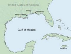
provided the french and spanish with an exploration route to mexico and america |
|
|
Great Lakes |
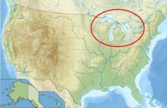
inland port cities grew here in midwest |