![]()
![]()
![]()
Use LEFT and RIGHT arrow keys to navigate between flashcards;
Use UP and DOWN arrow keys to flip the card;
H to show hint;
A reads text to speech;
17 Cards in this Set
- Front
- Back
|
Mississippi River |
transport farm and industrial products- the most famous river |
|
|
Coastal Range |
Rugged mountains along the Pacific Coast fertile valleys |
|
|
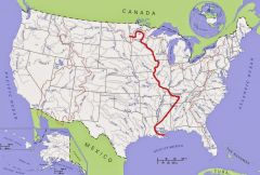
Missouri River |
transport farm and industrial products- longest river |
|
|
Basin and Range |
Located west of the Rockey Mountains and east of the Sierra Nevada and the Casades. Varying elevations with isolated mountain Ranges- Death Valley- lowest point in North America |
|
|
Ohio River |
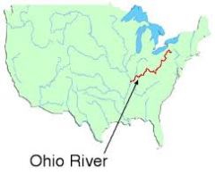
Gateway to the west |
|
|
Rocky Mountains |
Located west of the Great Plains and east of the Basin and Range. Rugged Mountains that stretch from Alaska to almost Mexico; high elevations. Continental Divide- determines which direction rivers flow
|
|
|
Columbia River |
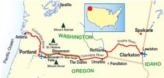
Explored by Lewis and Clark |
|
|
Great Plains |
Located west of Interior Lowland and east of the Rocky Mountains |
|
|
Colorado River |
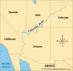
Explored by the Spanish (Corando) |
|
|
Interior Lowlands |
Located west of the Appalchian Mountains and east of the Great Plains. Rolling flatlands with many rivers, broad river valleys and grassy hills |
|
|
Atlantic Ocean |
Highway for explorers, early settlers,and later immigrants |
|
|
Appalachian Highlands
|
Located west of Coastal Plain extending from eastern Canada to western Alabama; includes the Piedmont
Old eroded mountains Oldest mountain range in North America |
|
|
Pacific Ocean
|
Early exploration destination
|
|
|
Coastal Plains
|
Located along the Atlantic Ocean and Gulf of Mexico
Broad lowlands that provide many excellent harbors |
|
|
Gulf of Mexico |
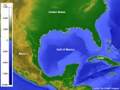
provided the French and Spanish with an exploration route to Mexico and America |
|
|
Canandian Shield |
Wrapped around Hudson Bay in horseshoe shape Hills worn by erosion and hundreds lakes carved by glaciers |
|
|
Great Lakes |
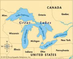
Inland port cities grew here in the middle |