![]()
![]()
![]()
Use LEFT and RIGHT arrow keys to navigate between flashcards;
Use UP and DOWN arrow keys to flip the card;
H to show hint;
A reads text to speech;
31 Cards in this Set
- Front
- Back
|
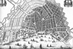
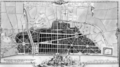
Amsterdam 1590 incremental planned growth linear/concentric |
|
|
Angkor Wat Jayavarman VII King of Khemer Empire 1125-1218 -city of temples -Oriented to the west -The walls and moat symbolize the surrounding mountain ranges and ocean -Concentric galleries |
|
|
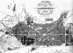
Barcelona Ildfonse Cerda 1859 -focused on the need for sunlight -effective sewerage to accomidate flooding - grid plan was used to accommodate pedestrians, carriages |
|
|
Chang-an, China 582 AD - Irregular terrain- makeshift capital - rectangular "bo" - every house facing the sun, and with a courtyard garden - emphasis on symmetry - focused on axis through cities that would point to natural sites that were worship spots - square city with rectangular gates |
|
|
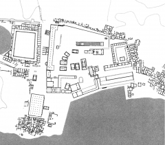
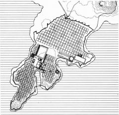
Delos, Greece 900 BC - 100 CE internally ordered forms which relate to one another & to natural terrain within - spaces are self-contained - different vantage points across the city - no blurred boundaries between manmade and natural |
|
|
Edinburgh, Scotland James Craig 1767 -Gridded expansion -Orthangonal Planning |
|
|
Jiapur, India 1700-1743 - avenue running from E to W - two main streets which run from N to S (which divides city into 9 parts) - Emphasis on square geometries - square geometries - building city to the rules of the mandala (sets rules for how city is to be built) - Purpose built city |
|
|
Kyoto Heiankyo, Japan 794 -1868 Orthogonal plan - high ground which meant closer to the Gods - symmetrical axial planning - tiny blocks throughout - Palace not symmetrical - Open spots consist of temples, public spots of worship - rivers and mountains on both sides - heirarchy of circulation patterns within blocks - migrate eastward |
|
|
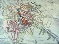
Berlin 1804 Gridded expansion Friedrich wilhelm |
|
|
New Orleans 1815 Montreal settler -formal square -community square -square grid with equal square widths -expanded in modules -square in center |
|
|
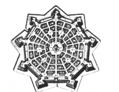
Palmanova Rennaisance Vincenzo Scamozzi 1593 -nine-sided polygon -central square is a rectangular hexagon -main civic buildings in center -grid iron within defensive perimeter |
|
|
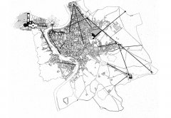
Rome, Bacon First diagram highlights imperial Rome Second diagram highlights the topography with sixus V |
|
|
London Sir Christopher Wren 1666 (sometime directly after fire of 1666) -Entrance of the town were its gates and bridges - Entrance to give easy access to all parts of the town - Main central square - Four green squares of space around it - Super imposition of grid |
|
|
Rome Pope Sixus V 1585-1590 - Orthagonal planning - Roman military encampment - Emphasis on axiality and heirarchy - N & S orientation - Campus Martus (gridded) - made restorations |
|
|
Miletus, Greece 490 BC hippodaumus -grid iron plan -gridded expansion -orthagonal -fortifications -central public space |
|
|
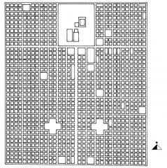
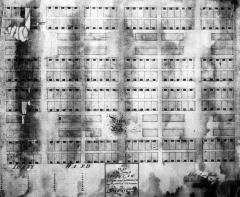
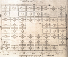
Savannah Oglethrope 1733 - based on repition of ward unit - 40 house lots and 4 sites reserved for public buildings - Wards have a green space in the middle - very democratic |
|
|
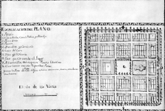
San Antonio |
|
|
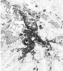
Sienna, Italy - Geomorphic growth - densely populated street areas - tight and organic patterns - based on geomorphic planning - center point main public area |
|
|
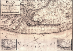
St. Louis |
|
|
Timgad, algeria 100 AD Emperor Trajan - Built to house veterans of the third legion, diving land equally, 25+ years of war was required - major linear focus in the grid organization - Intense centralization of power |
|
|
Williamsburg 1705 Francis Nicholson - Strong cross axis to the public access - streets large, houses tiny - Long skinny lots on the outskirts of the city rep resent agriculture types of people that worked the land - river intended for transportation -senator's house in the center - |
|
|
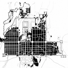
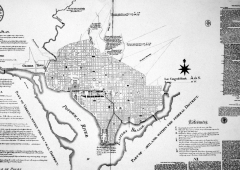
Washington L'Enfant 1791 Views down long stretch of the potomac River - Openness in relation to the river - Mall at junction of the two axes - Grid - symmetrically arranged main routes - Links between White House and Capital would be linked through lined planted trees |
|
|
London Richard Newcourt 1666 -imposition of the grid -main central square -seperate parishes with their own church in the center - center square was for St. Paul's |
|
|
Miletus Greece info |
-emphasis placed on symmetrical arrangement of architecture, giving more formal character to the civic open spaces -Repetitive module of the regularrectangular blocks which constitute theresidential part of the city sets up arhythm which is the basis for thecomposition of the public parts of thecity, temples, gymnasia, and the stoasfacing inward toward the agoras andout toward the harbors |
|
|
Ch' and-an, China palace |
- built on on the northern side and facing south (done for military purposes and also a large hunting ground directly behind) - Admin city adjoining in the south |
|
|
Uses of orthogonal planning |
-palaces & religious or admin complexes, -Ritual or ceremonial axial planning -temporary encampment: military, rebuilding, planned colonies, expansion of existing cities, planned imperial cities |
|
|
Main Attributes of orthogonal Planning |
Scale, heirarchy, geometry, symmetry, continuity, orientation, relation to topo, religious/administrative |
|
|
Main categories of orthogonal planning |
orthogonal (use of right angles), combined (most common), axial, Grid iron, tartan grid, checkerboard |
|
|
Palimpsest |
Layered or superimposed or placed on top of the other - incomplete erasure |
|
|
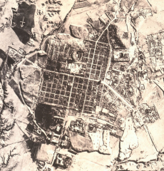
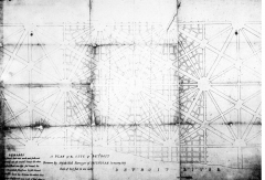
Detroit, Michigan 1807 Augustus Woodward - Rectilinear grid -absense of square -streets parallel to the water -made up of increments of triangular blocks -overall inefficient planning |
|
|
Orthagonal |
- streets intersecting at right angles to form blocks of regular size and spacing |