Reading...
![]()
Play button
![]()
Play button
![]()
Use LEFT and RIGHT arrow keys to navigate between flashcards;
Use UP and DOWN arrow keys to flip the card;
H to show hint;
A reads text to speech;
131 Cards in this Set
- Front
- Back

|
danger
|
|
|
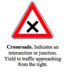
crossroads
|
|

|
crosswalk
|
|

|
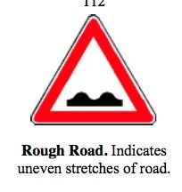
rough road
|
|
|
|
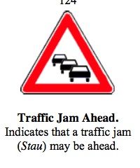
traffic jam
|
|
|
rough road
|
|
|
traffic jam ahead
|
|
|
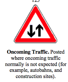
on coming traffic
|
|
|
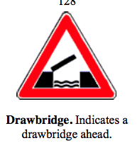
drawbridge
|
|
|
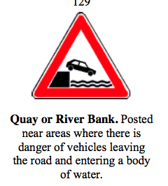
quay or river bank
|
|
|
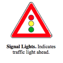
signal lights ahead
|
|
|
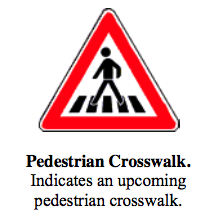
pedestrian crossing
|
|
|
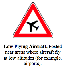
low flying aircraft
|
|
|
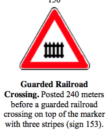
guarded railroad crossing
|
|
|
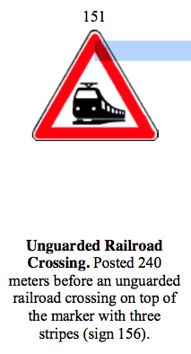
unguarded railroad crossing
|
|
|
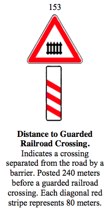
distance to guarded railroad crossing
|
|
|
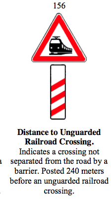
distance to unguarded railroad crossing
|
|
|
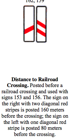
distance to railroad crossing
|
|

|
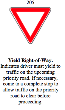
yield right-of-away
|
|
|
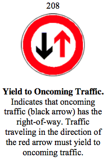
yield to oncoming traffic
|
|
|
yield right of way
|
|
|
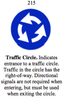
traffic circle
|
|
|
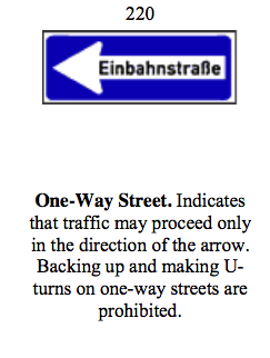
one way street
|
|
|
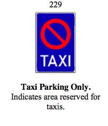
taxi parking ONLY
|
|
|
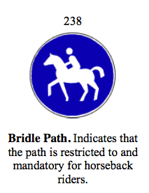
bridle path
|
|
|
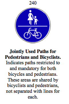
joint path for ped + bikes
|
|
|
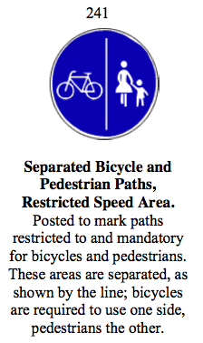
separate bikes + peds path - restricted speed area
|
|
|
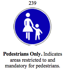
peds ONLY
|
|
|
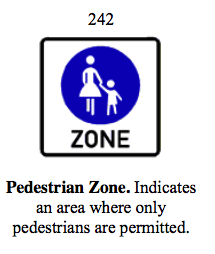
peds ZONE
|
|
|
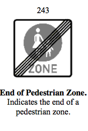
end of ped ZONE
|
|

|
end of ped ZONE
|
|
|
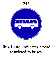
bus lane
|
|
|
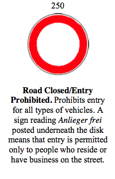
road closed/entry prohibited
|
|
|
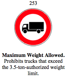
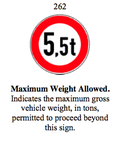
max weight allowed
|
|
|
max weight allowed
|
|
|
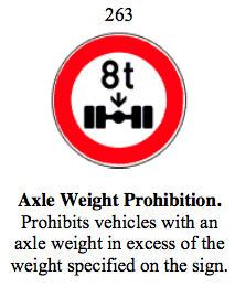
axle weight prohibition
|
|
|
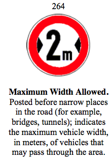
max width allowed
|
|
|
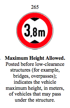
max height allowed
|
|
|
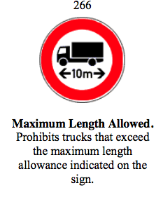
max length allowed
|
|
|
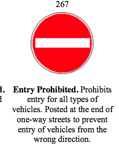
entry prohibited
|
|
|
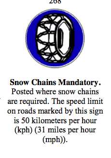
snow chain mandatory
|
|
|
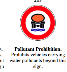
pollutant prohibited
|
|
|
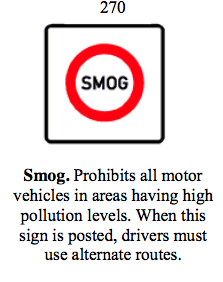
smog
|
|
|
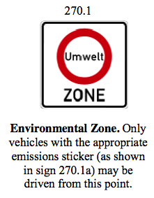
environmental zone
|
|
|
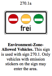
environmental zone vehicles allowed
|
|
|
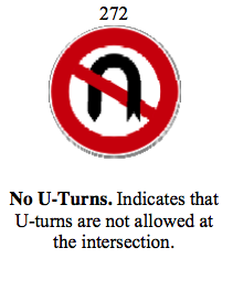
no U turns
|
|
|
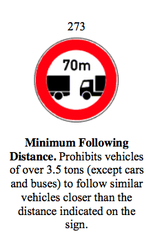
mini following distance
|
|
|
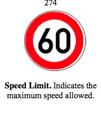
speed limit
|
|
|
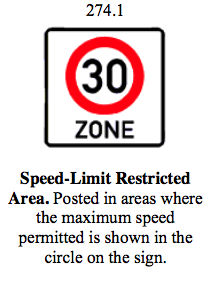
speed limited restricted area
|
|
|
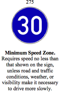
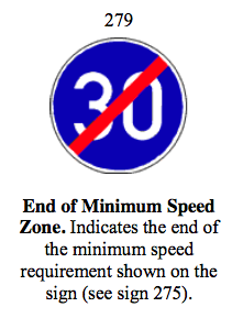
mini speed limit
|
|
|
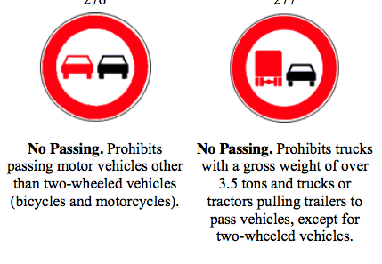
no passing
|
|
|
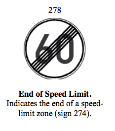
end of speed limit
|
|
|
end of mini speed ZONE
|
|
|
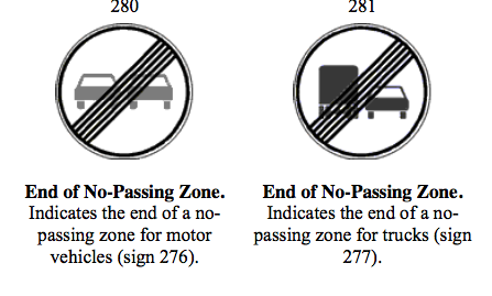
end of no passing zone
|
|
|
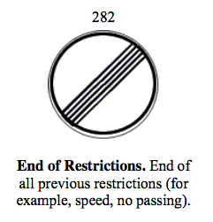
end of restrictions
|
|
|
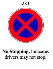
no stopping
|
|
|
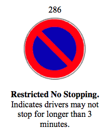
restricted NO STOPPING
|
|
|
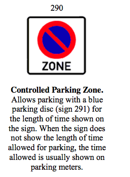
controlled parking zone
|
|
|
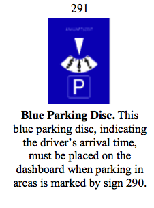
blue parking disc
|
|
|
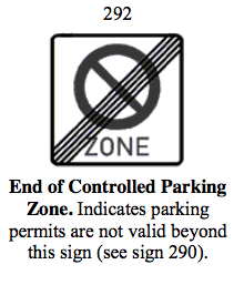
end of controlled parking zone
|
|
|
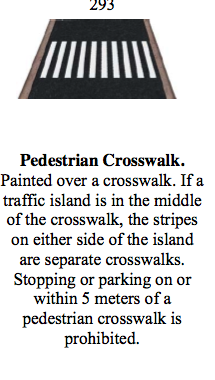
peds crosswalk
|
|
|
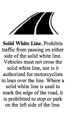
solid white line
|
|
|
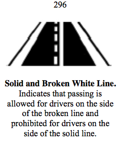
solid + broken white lines
|
|
|
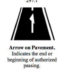
arrow on pavement
|
|
|
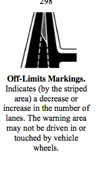
off limits marking
|
|
|
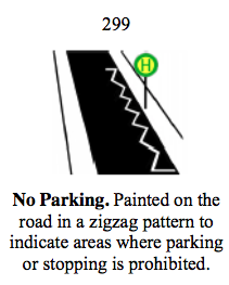
no parking
|
|
|
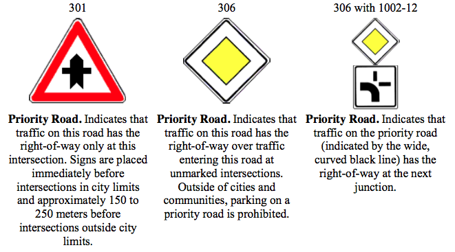
priority road
|
|
|
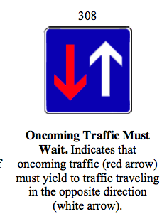
oncoming traffic MUST WAIT
|
|
|
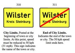
city limits
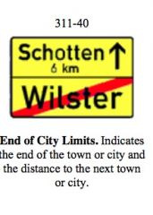
end of city limits |
|
|
end of city limits
|
|
|
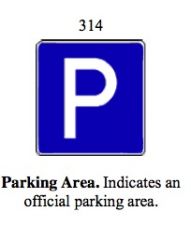
parking area
|
|
|
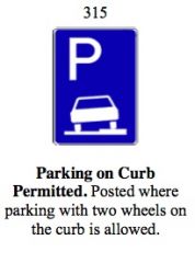
parking on curb permitted
|
|
|
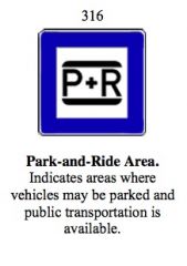
park and ride area
|
|
|
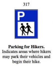
parking for hikers
|
|
|
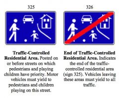
traffic controlled residential area
end of traffic controlled residential area |
|
|
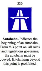
autobahn
|
|
|
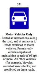
motor vehicles only
|
|
|
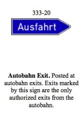
autobahn exit
|
|
|
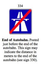
end of autobahn
|
|
|
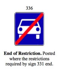
end of restriction
|
|
|
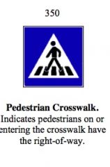
peds crosswalk
|
|
|
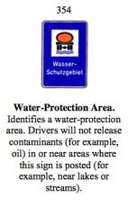
water protection area
|
|
|
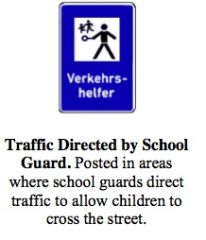
traffic directed by school guard
|
|
|
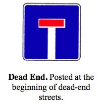
dead end
|
|
|
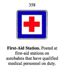
first aid station
|
|
|
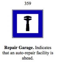
repair garage
|
|
|
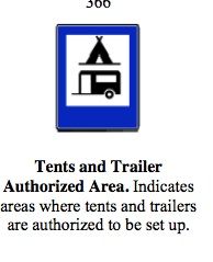
tents + trailers authorized area
|
|
|
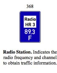
radio station
|
|
|
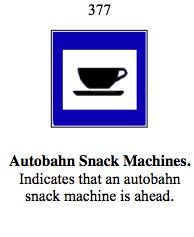
autobahn snack machines
|
|
|
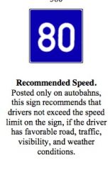
recommended speed
|
|
|
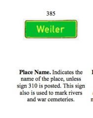
place name = GREEN
|
|
|
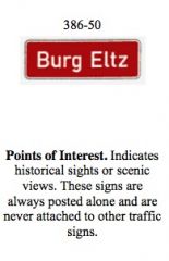
point of interest = RED
|
|
|
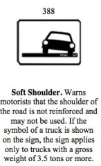
soft shoulder
|
|
|
|
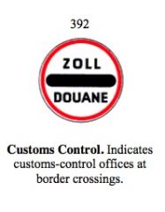
customs control
|
|

|
custom control
|
|
|
customs control
|
|
|
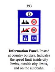
information panel
|
|
|
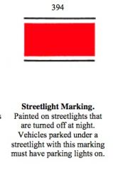
streetlight marking
|
|
|
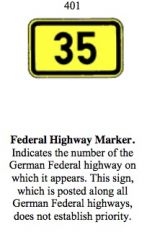
federal highway marker
|
|
|
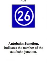
autobanh junction
|
|
|
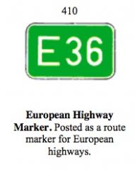
european highway marker
|
|
|
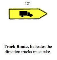
truck route
|
|
|
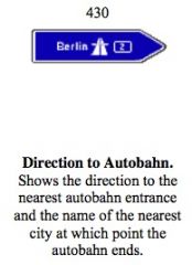
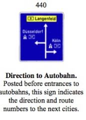
direction to autobahn
|
|
|
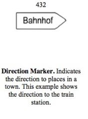
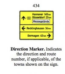
directional marker
|
|
|
|
directional marker
|
|
|
directional marker
|
|

|
directional marker
|
|
|
direction to autobahn
|
|
|
|
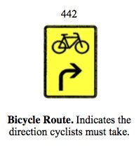
bike route
|
|

|
bike route
|
|
|
bike route
|
|
|
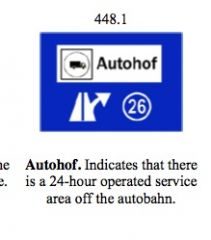
autohof
|
|
|
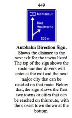
autobahn directional sign
|
|
|
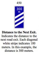
distance to the next exit
|
|
|
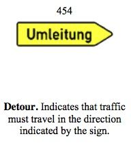
detour
|
|
|
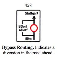
bypass routing
|
|
|
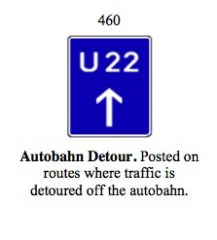
autobahn detour
|
|
|
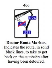
detour route marker
|
|
|
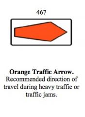
orange traffic arrow
|
|
|
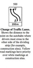
change of traffic lanes
|
|
|
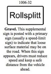
gravel
|
|
|
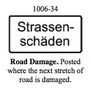
road damage
|
|
|
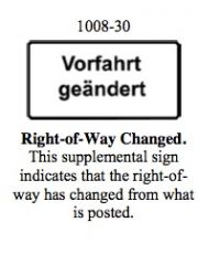
right of way changed
|
|
|
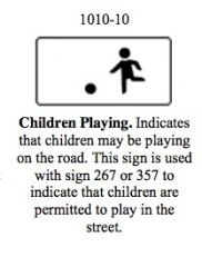
children playing
|
|
|
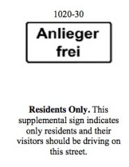
residents only
|
|
|
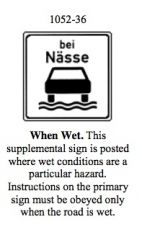
when wet
|
|
|
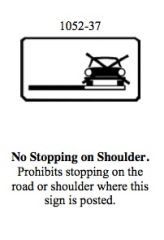
no stopping on shoulder
|
|
|
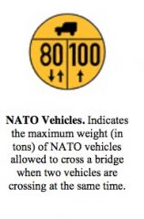
NATO vehicles
|
|
|
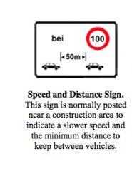
speed + distance sigm
|
|
|
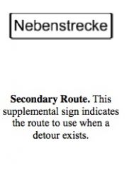
secondary route
|
|
|
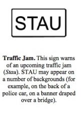
traffic jam
|