![]()
![]()
![]()
Use LEFT and RIGHT arrow keys to navigate between flashcards;
Use UP and DOWN arrow keys to flip the card;
H to show hint;
A reads text to speech;
14 Cards in this Set
- Front
- Back
|
Sea level starts at |
Zero |
|
|
Bench Mark |
exact elevation at that spot & tells the date of the measurement |
|
|
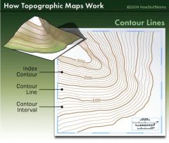
Contour Lines |
lines that connect points of equal elevation. (all points on the line are exactly the same) |
|
|
Contour lines up hill |
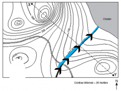
Water flows in opposite direction |
|
|
Small dashed lines |

Depression |
|
|
Drawing a profile |
a side look (remember that a profile of your face is a side view, so a profile of a part of a topographic map is a side view of just that specific place) |
|
|
Black |
Man made features (buildings, roads, mines) |
|
|
Red |
Significant man made features (highways, govt area) |
|
|
Pink |
Density populated urban area |
|
|
Close contour lines |
Steeper slopes |
|
|
White |
Area of no vegetation |
|
|
Green |
Vegetation (forests, grasslands) |
|
|
Blue |
Water (sea, ocean, lake, river, pond) |
|
|
Topographic Maps |
|