Reading...
![]()
Play button
![]()
Play button
![]()
Use LEFT and RIGHT arrow keys to navigate between flashcards;
Use UP and DOWN arrow keys to flip the card;
H to show hint;
A reads text to speech;
23 Cards in this Set
- Front
- Back
|
Mathematical Geography: Description of the earth using numbers and measurements
|
|

|
Universe: all of Heavenly Father and Jesus' creations
|
|
|
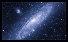
Galaxy: a very large group of stars and all matter surrounding them
|
|
|
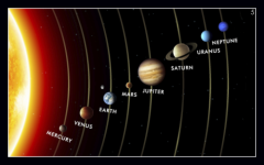
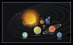
Solar System: the sun together with the planets and matter that are held by its attraction and revolve around it
|
|
|
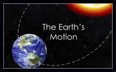
The Earth's Motion: how the earth moves in the solar system
|
|
|
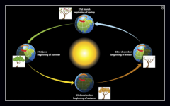
Orbit: the path Earth takes around the sun; It takes one year or 365 days to orbit the sun once.
|
|
|
Seasons: the four quarters into which the year is divided by a particular kind of weather; winter , spring, summer or fall; Seasons are based on the position of the earth in its orbit around the sun.
|
|
|
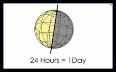
Axis: a central, straight, imaginary line about which the earth rotates; One rotation equals one day, or 24 hours.
|
|
|
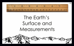
The Earth's Surface and Measurements
|
|
|
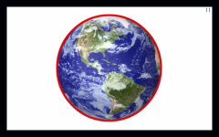
Form: shape of Earth; Earth is actually a sphere flattened along the axis from pole to pole such that there is a bulge around the equator.
|
|
|
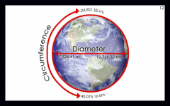
Dimension: the size of the earth
|
|
|
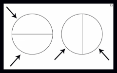
Great Circles
|
|
|
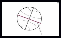
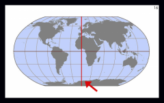
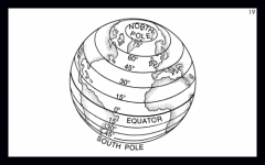
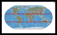
Equator: the great horizontal circle of the earth that divides the earth into two equal parts
|
|
|
Hemisphere: half of a sphere or globe; one of the halves of the earth. There are four hemispheres: northern, southern, eastern, and western.
|
|
|
Prime Meridian: the meridian of 0 degrees longitude from which all other longitude lines are measured
|
|
|
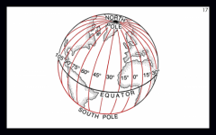
Longitude Lines: imaginary lines equally distant from the poles. Longitude is computed from 0–180 degrees East and West of the Prime Meridian at Greenwich, England.
|
|
|
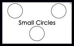
Small Circles
|
|
|
Parallels/Latitude Lines: imaginary horizontal lines moving by degrees north and south from the equator
|
|
|
Climatic Circles/Tropics:
TROPIC OF CANCER - the latitude line that is about 23½ degrees north of the equator; the north most latitude reached by the overhead sun TROPIC OF CAPRICORN - the latitude line that is about 23½ degrees south of the equator; the southernmost latitude reached by the overhead sun |
|
|
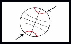
Polar Circles: either of the two parallels of latitude each at a distance from a pole of the earth equal to about 23 degrees
|
|
|
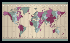
Time Zones: a region on the earth where the same standard time is used
|
|
|
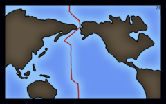
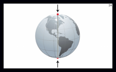
International Date Line: an imaginary line near the 180th meridian marked as the place where each calendar day begins
|
|
|
Poles: the ends of the axis of the earth
|